Heart of Conservation PodcastEp#31 Show Notes (Edited)
Introduction:
Hi, I am Lalitha Krishnan and you’re listening to Ep# 31 of Heart of Conservation. I bring you stories from the wild that keep us all connected to our natural world. You can listen to Heart of Conservation on several platforms and also read the transcript right here on my blog Earthy Matters.
Today’s episode is about the Sundarbans. I recently made a trip there and I have to tell I am so spell bound by the immensity and biodiversity of the world’s largest delta which we share with Bangladesh. To be honest, I didn’t know about these 2 facts earlier. Almost everything I saw was unique somehow, something I had never seen before. I knew I had to find an expert to learn more about the Sundarbans ecosystem. As luck would have it, I came across a social media account @onesundarban which belongs to Dr Radhika Bhargava, my guest here on episode # 31.
In her own words, Dr Radhika wears multiple hats as a coastal geographer, geospatial analyst, and a National Geographic Explorer. She is a Research Fellow at the NUS Centre for Nature-based Climate Solutions working with wetland conservation in Asia. She recently completed her PhD at the National University of Singapore. We will discuss her research some more but for now, Radhika, welcome and congratulations on your PhD. I feel so privileged to have you share your knowledge and experiences with us.
Radhika Bhargava: Hi Lalitha, thank you so much for having me on your podcast. I am so excited and I am so happy that you recently visited the Sundarbans. I am really looking forward to your questions and interacting with you on Sundarbans.
Lalitha Krishnan: Lovely. So, let us start. Radhika, what made you, first, focus on the mangroves for your research and why must we be watching the mangroves to check on the health of our planet?
Radhika Bhargava: I started working on mangroves during my Masters actually. I was part of a project where they were looking for someone to do coding or use coding /computer languages to identify mangroves of South East Asia. So, you use satellite images and you have to interpret where the mangroves are. There were many other forest classes that I was interested in studying but somebody had taken up those classes or somebody had taken up those forest areas to study using satellite imagery. They were only left with mangroves and then, I joined the lab. Nobody was willing to take up this project because there was a lot of computer coding required. And, coming from ecology, biology or management backgrounds, we were not trained in it. I saw this gap and evenI didn’t know any computer programming at that time. But then, looking at this desperate need that nobody is doing, I said, “Sure, why not? I will give it a try.” I started learning coding from scratch and then my focus was mangroves. So, that is how I learnt a lot about mangroves. I became so curious that through the two years of my Masters which was at University of San Francisco, the focus was Environmental Management. I ended up with all my class projects or side projects related to mangroves. That’s how I came across the Sundarbans.
3:56
You asked me, “why must we be watching the mangroves to check on the health of our planet?” There are many reasons. Especially that mangroves are coastal protectors. They protect the sea from storms and cyclones. Their roots help in purifying water but specially they store or remove carbon dioxide which causes global warming. They store it within themselves and keep it there for millions and millions of years. They have such characteristics that can tell about the health of the planet and actually help in improving the health.
4:30
Lalitha Krishnan: That’s quite amazing. I love the part about you learning coding from scratch. Look where it has taken you. Radhika, I’m curious about your social media handle. Why its called ‘One Sundarban? There must be something to it. There must be a good reason why you have called it so?
4:56
Radhika Bhargava: So glad you asked me this question because initially, people thought that maybe I did not get the handle “Sundarbans’ and that it why I went with ‘One Sundarbans’. Also, I think, I have had that account for maybe two years. I only joined social media because I felt the urge to share about the Sundarbans. When I realised that a storm can come, a cyclone can come in that area and nobody would even know that somethings happening… So, I felt that I am at a place that I can share so I should take that initiative. So, I only joined social media to share about Sundarbans.
And why ‘One Sundarban’?
Sundarbans is across India and Bangladesh. It is one ecosystem. As a researcher, it really annoyed me initially when I would come across studies or management plans or government records that focused on just one side-either India or Bangladesh. So, for me, ‘One Sundarban’ is one ecosystem so hence ‘One Sundarban’ but after I pondered about it a bit more, about the terminology, I realised that “sundar” is in Hindi, In Bangla and in many local Indian languages, “sundar” is beautiful and “ban” or “van” is forest. So, it is just one beautiful forest. If I branch out of onesundarban, this name still holds.
-Radhika Bhargava
6:37
Lalitha Krishnan: Right. That is a beautiful thought and it makes so much sense because you cannot save it in part. It is half the story then. Radhika, how much ground did you cover during your research and what techniques did you employ to cover this vast area?
6:59
Radhika Bhargava: Right. So, I worked across India and Bangladesh. So, Sundarbans, for those who are not familiar, is 10,000 sq. kilometres of just mangrove forests. It is made up of many small islands-I do not even know the exact count-but, adding both India and Bangladesh, it is going to be more than 200 islands. My initial idea was to capture the ecosystem. Since I use geo-spatial analysis, which means using satellite maps and satellite data to understand what is happening on the ground, I was able to understand that from one aspect, right? Since satellite images can help you cover that vast area but when I went into the field, I still intended to go from the easternmost to the westernmost and northernmost to the southernmost island. For that, I first recorded shorelines from on top of a boat. I installed a Go Pro camera on a boat and then we would go parallel across shorelines and then I would be doing a commentary on those videos. Later on, I converted those videos into multiple images, and so from the observations in those images and my commentary, I collected some data.
8:25
So, we covered around 240 kilometres just of observation. The travelling kilometres were much more. And then, I went to around 16 villages to conduct interviews with the communities to understand their part of the story of the work I was doing.
8:53
Lalitha Krishnan: That is very extensive. You must have learnt a lot. That is quite amazing Radhika.
9:01
Radhika Bhargava: Thank you so much. If not for COVID, I had another few methods I wanted to try out too which would have made me go into the forest to collect some forest bio-physical measurements within the forests but because of COVID, I had a shorter amount of time and PhD scholarship and all restricted me. So, there was still more that I wanted to do.
9:24
Lalitha Krishnan: But you must have amassed quite a lot of information.
9:29
Radhika Bhargava: It took a long time to process it. I think I would still go back to that data set although I have written my thesis on it, there is still so much more to get from it. I hope I get a chance to do that in the future.
9:41
Lalitha Krishnan: I am sure (you will). These things never go to waste – what you’ve observed, what you’ve learnt and what you have surveyed. You know, even though I have lived by the sea, I never bothered to familiarize myself with mangroves. It was in the Sundarbans, that too on a boat that I witnessed up close, the diversity of mangroves species. They are quite different from each other apart from the fact that they seem to be thriving in this cocktail of river and sea. Could you talk about some of these mangroves species and how unique they are? The snake roots, breathing roots for e.g. or the way some species propagate themselves with seed balls that float till they find a suitable location? It is all so fascinating.
10: 34
Radhika Bhargava: In just a few lines you actually explained how one comes across and becomes fixated with mangroves. Initially you lived by the sea, I come from a land-locked place. So, I had not even heard the word ‘mangroves’. So even today when I tell people I am doing research on mangroves, they assume I am researching mangoes. The word is so unfamiliar.
Lalitha Krishnan: There’s somebody worse than me that means.
11:13
Radhika Bhargava: I was worse than you. Despite visiting coastal areas with my parents, I never processed why there are trees on the beach or why there are trees on the water. Especially in Bombay. Goa, Gujarat side of India. So, I also learnt about it through books and through reading research papers until I went to the Caribbeans to do some project on coral reefs. So, we had a small project where we were snorkelling and looking at fish nurseries around mangrove roots. So, I thought that was cool. But I did not realise that there’s this amazing ecosystem like Sundarbans or Bhitarkanika in Odisha, where in sediment-rich mangroves you can’t even see what’s happening under water. So, I also came to mangroves in a similar way; I said “what are these crazy roots?” A lot of people whom I have talked to say mangroves for them are like some sci-fi movie, when they come to the Sundarbans.
12:14
It is mainly because of the roots like you said. Mangroves have this crazy kind of roots, especially to adapt to the extreme environment they grow in. By extreme environment, I mean they grow at the interface of land and water. So, they are often flooded with salt water although they receive some fresh water from rivers as well. They get flooded twice a day during high tide. They are exposed to extreme waves. When I am explaining this, I like people to imagine that these mangroves are humans. Or to become mangroves themselves. So, if you’re standing at such a place or if you are to stay there for so long, you would develop some kind of adaptation that would help you first, stand there steadily. That the hold of the roots… the snake roots or the prop roots as it is called. that helps them stay aground. There are four to five kinds of mangroves roots. Basically, the first role they play is help them stay in that silty, flooded land. The second thing specially in the Sundarbans or Bhitarkanika, where there is a lot of sediment that these mangroves are standing on, the second thing they need to do is to be able to breathe. But the soil and the water mix are so poor in oxygen content that they have to grow their roots up or their roots have to come from their branches and then go into the ground, unlike other plants which grow roots hidden in the ground. So the roots that are propping up from the ground-there’s a type of root called pencil roots- which look like if you’ve stuck pencils in the soil, they look like that. Or buttress roots… All of these roots apart from giving them stability, they also help them get oxygen from the air. So, many plants get oxygen from the atmosphere directly and through their leaves and through their stems but mangrove roots also get oxygen content from the air to support breathing for the plants. So, these are some adaptations that mangroves must bring in to stand tall in that extreme environment.
Source: Nature Picture Library
You also asked about propogation of species. How mangroves grow mangrove babies, right? So, if you are a mangrove and you’ve figured out how you are going to stand and how to breathe in this fragile, dynamic ecosystem then the next thing is to figure out how are we going to reproduce? Unlike many trees which produce seeds–those seeds get propagated by wind or by animals or by water–some of the mangrove trees do produce fruits. And then within these fruits, there are seeds which finally find a ground and grow. But, it’s also common in certain kinds of mangrove species to not produce seeds but produce a mangrove propagule. That propagule is just a mangrove baby that’s growing on top of its mom. You might have come across these green sticks hanging from the tree, they are mangrove propagules. They hang from the tree and until they are ready to go- the weather conditions, the time of year, the tidal conditions etc are good-the mom drops them in the water. Now they are floating in the water but these are not seeds ready to be germinated. These are germinated plants which function like any other plant and it keeps floating until it finds the right elevation, the right tidal conditions, the right slope, and the right area to settle in. So, that stick or propagule has that much sense to find the right place for its survival. It floats horizontally. Once it finds the right place, it becomes vertical, the centre of mass changes and it automatically goes into the soil. Which is just mind-blowing for me. In a way, they are like mammals. In mammals…humans, babies grown within the mum until they are ready to come out. I find equal similarities.
17:19
Lalitha Krishnan: It sounds like they have an intelligence of their own. There is so much we do not know.
17: 25
Radhika Bhargava: There are things people who study these processes are still finding out. Things we know have been published but there is so much more, so much unknown when it comes to mangroves.
17:41
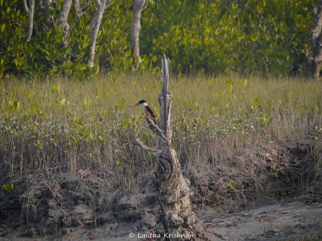
Lalitha Krishnan: Thank you so much for explaining that. Talking of species, the animals that exist in the Sundarbans also seem to have adapted to this unique environment. We saw the rare Mangrove pitta, the Fishing cat we didn’t see but I know it’s there and the swimming Bengal tiger, which is the only tiger that lives in a mangrove system. How cool is that? What makes them so different or what can you tell us about them?
18:19
Radhika Bhargava: If we are talking about Sundarbans, how can not (talk) about the tiger? The Royal Bengal tiger is found in many places in India or in the South Asian subcontinent. However, the subspecies of the Royal Bengal tiger—I’m not sure if sub-species is the correct word—but the evolution of the Royal Bengal tiger that found in the Sundarbans is quite different from the other Royal Bengal tigers that are found, in say, Central India, where I come from.
18:59
The main difference in their adaptation to living in the Sundarban Delta. In those mangroves, in that flooded ecosystem. Just like I was explaining earlier how mangroves adapted to this soil, sediment, flooding conditions, the tigers of the Sundarbans also have to.
19:22
If you are a tiger, you would need sweet water or fresh water, as they say, to survive. But the tigers of the Sundarbans are living in a delta filled with salt water. Their houses or their land or their habitat, gets flooded twice a day which tigers of Central India do not experience.
They go to a fresh water pond within their forest to get water but then they can go back to their caves to chill. But there are no such structures that are dry all year around for the tigers of the Sundarbans. And if they want to go from one place to another, there are huge rivers and streams in between which they have to traverse. So, tigers and other kinds of cats can swim naturally but the tigers of the Sundarbans use swimming as their means of transportation. When their islands get completely flooded because of high tide they climb on to a tree and stay on the tree twice a day during high tide conditions. Hunting also, for for these animals is very different. Now you don’t have a grassland to run and catch deer but you have to very strategically traverse the silty, quick-sand type or quick-mud type of terrain where you cannot run a lot because of the roots–that I just explained about earlier—would stop you from running far distances.
21;10
So, it so amazing how the Royal Bengal tigers of the Sundarbans have adapted to live in these conditions. However, these extreme conditions- lack of habitat these days, lack of availability of sweet-water ponds and extreme environmental and anthropogenic pressures are affecting these tigers in a way that now, they are more exposed to the local villages. A lot of human and tiger negative interactions have started to take place. There are a lot of theories of why some of these tigers are also maneaters. These theories that make sense to me are related to the extreme environment and increasing environmental and anthropogenic pressures that are making them encounter humans in a negative aspect.
22:19
Lalitha Krishnan: Right. I imagine tigers or for that matter any other animal there having to climb a tree twice a day to escape drowning if they cannot swim. I never would have even thought that far. Thank you for explaining that. It is quite a hard life even for a tiger. I was thinking of the deer…
22:40
Radhika Bhargava: Did you see any tiger?
22:41
Lalitha Krishnan: No, we did not see any tiger and we did not expect toeither. They told us not to expect to see a tiger. But we did see paw prints. What is fascinating is that—I have seen scratch marks of tigers on trees but here, we actually saw scratch marks on the mud. We had such an excellent forest guide. Mud looks like mud; it was all wet but he manged to point that out to us. It was quite distinct. That was fascinating.
23:14
Coming back to the Sundarbans and the ravages of nature, Cyclone Bulbul in 2019, Cyclone Amphan in 2020, Cyclone Yaas and Jawad in 2021 have all struck and affected these low-lying islands. What makes them so defenceless? What were the losses incurred with every cyclone-hit?
23:50
Radhika Bhargava: The “defenceless” word here is something I should talk about. It’s Yes and No. Mangroves are known to protect inland areas from the impacts of storms and cyclones. So, in a way they are not defenceless. They have those defences. And, even the all the cyclones that you named just now; Kolkata was the least impacted if we are speaking from India’s perspective or Khulna or Dacca if we are speaking from Bangladesh’s perspective. They were impacted but the impact was so small compared to what it could have been if the Sundarbans was not there. So, Sundarbans is still holding ground, defending inland areas.
However, because of ongoing anthropogenic pressures; to name a few: the shipping channel that has been formed within the Sundarbans which is a protected area. It should not be converted into a water highway.
Or a coal plant coming into Sundarbans or other aspects, the extreme erosion of land; the loss of land which was the focus of my research, causing mangroves to degrade and get lost is causing them to reduce the amount of defence they could have provided.
25:28
When you are talking of defence I would also talk about the people. The people of the Sundarbans, I feel are resilient especially in terms of how they manage when these reoccurring cyclones, with the frequency of three to four times a year, impact them. However, with reduced options of livelihood, with reduced preparedness because they are managing a lot of land, and cyclones, lack of livelihoods, lack of protection altogether, their resiliency is also getting reduced.
So, although the people are not defenceless to start with, the conditions are making them such. So, if you hear, I just made a parallel between the resiliency of the mangroves and the resiliency of the people; yet both their resiliencies are getting reduced or impacted. Which on a side note is the conclusion of PhD thesis.
26:38
Lalitha Krishnan: Good. So, during my visit to the Sundarbans, I noticed that the embankment to my resort was half washed away. I was told it was the cyclone which is a recurring factor there. Is there more to it?
26:51
Radhika Bhargava: Great observation Lalitha. I am so glad that you didn’t buy into just the story that a cyclone comes and destroys the structure. So, to give a bit more context to our audience, the soil in the Sundarbans , the sub-sediment in the Sundarbans is silty; it’s clayish. So, if you want to understand this, clay that a potter uses to mold clay into, it is that kind of clay, on which if you put a step, just as a 55kg human, the soil is going to get compressed and you’re going to slip away.
Imagine putting concrete slab on this silty and soft soil? It’s like creating a hard line in a very dynamic system. That concrete is going to eventually collapse. I’ll explain very quickly how. So, there’s a concrete slab but underneath, is a soft silty soil. And underneath, there are waves that are coming in and out throughout the day, So the waves are going to take some of that soil with them. Or that soil which may be a bit harder during low tide is going to get mixed with water and become soft. So, the concrete slab on top is eventually and slowly and slowly going to collapse. And, then, it’s going to be like the embankment that you saw during your visit.
So, when a cyclone comes, all of this just gets exaggerated. But these processes are happening on a daily basis, causing these embankments to fall and collapse. Yet, when these embankments fall, another embankment of such poor design is built maybe 200 mts. away from the current shoreline. This keeps on repeating to the point where the place you stayed, you saw the 5th embankment collapse in the past 40 years or so. This is something I also worked on during my PhD to understand why this poorly designed embankments are still around and how are they impacting the local people. So, what I explained earlier about the reduced preparedness or resiliency of the people, that lack of preparedness, that lack of having other options make them rely on these quick yet poor solutions. So, the demand also increases for these. One thing collapses, yet the second time, they want the same thing to be built so that they can get some short-term benefits of prevention of flood or some people start living in tents- who have also lost houses because of all of this, start living around the embankment. So, it becomes like a vicious cycle of land loss, poorly designed embankments come in, poorly designed embankments cause more land loss yet more of these embankments come in and the cycle continues.
30:00
Lalitha Krishnan: Again, I never thought of it. I am learning so much from you Radhika. Finally, my last question for you. Could you share a word that was perhaps part of your research or significant to you in some way? Something new for all of us.
30:16
Radhika Bhargava: So, the word I want to use, building off of what I just explained about embankments, is a word called ‘maladaptation’. It is very relevant because in the last IPCC report, it was used to highlight a pressing issue in our fight against climate change. I will explain it in pieces. Adaptation means any form of project, idea or implementation that comes in to reduce impact or anything. But in climate change context, climate change adaptation is an adaptation such as building a sea wall, or other things that help you reduce the impact of climate change. So one impact could be flooding, sea-levels rising and so on. Maladaptation to climate change means when that adaptation which is built to reduce the impact of climate change fails but not only does it fail but it causes other negative impacts to the local community or the global community.
31:31
So, when an adaptation fails and causes more negative impact it turns into a maladaptation. This is a word that I realise through the work I have done in the Sundarbans, or through my research in the Sundarbans, and I am hoping that I can contribute more to the growing literature of maladaptation.
31:56
Lalitha Krishnan: You have increased our vocabulary. Thank you so much Radhika, we have covered a lot and learnt a lot from you. It’s been a real pleasure talking to you.
Radhika Bhargava: Thank you so much Lalitha. I love talking about the Sundarbans and sharing about it from a place where I did not know and then I had the privilege to go and learn about it. So, I feel that it’s my responsibility in a way to share about it in any medium and form I can. So, thank you so much for giving me this platform to talk more about Sundarbans and the issues people and the forests are facing over there.
32:35
Lalitha Krishnan: Thank you Radhika, I feel the same way. I feel there’s so much we don’t know and I want to share. I am luck I found you.
32:47
Radhika Bhargava: One quick thing to add for our listeners. So, you learnt a lot about Sundarbans, and mangroves. So, one takeaway you can do for me and Lalitha would be if you can go and tell more people in your social circles about how cool and awesome mangroves are and how amazing Sundarbans is. Thank you.
Lalitha Krishnan: I hope you enjoyed listening to episode #31 and Dr Radhika as much as I did. If you know somebody who is doing incredible work and his/her story needs to be shared do write to me at earthymatters013@gmail.com Watch out for my next episode. Till then, take care. Bye.
Birdsong by hillside resident, the collared owlet.
Cover photo: courtesy Dr Radhika Bhargava. Podcast cover artwork by Lalitha Krishnan
Disclaimer: Views, thoughts, and opinions expressed in the podcast and show notes belong solely to the guest featured in the episode, and not necessarily to the host of this podcast/blog or the guest’s employer, organization, committee or other group or individual.
Lalitha Krishnan:Hi guys. Thanks for listening in to Heart of Conservation Podcast (Ep#15). I’m your host Lalitha Krishnan. I hope you’re staying healthy, washing your hands regularly, and keeping sane. Talking of water, there are a lot of people in our country (India) who don’t have access to running water. I’m not going to say more. Let me introduce my guest Aditi Mukherji. She’s a Principal Researcher at the International Water Management Institute. She is a human geographer by training with a Ph.D. from Cambridge University, the United Kingdom where she was a Gates Cambridge Scholar. She has over 20 years of experience working on policies and institutions of water resources management with a special focus on water-energy-food nexus. She is the first-ever recipient of the Borlaug Field Award (2012) endowed by the Rockefeller Foundation and given by the World Food Prize Foundation, USA.
Aditi is the coordinating lead author of the water chapter of the Sixth Assessment Report (AR6) of the Intergovernmental Panel on Climate Change (IPCC), which is to be published in 2021. In her previous job as the Theme Leader of the Water and Air theme at the International Centre for Integrated Mountain Development (ICIMOD) in Nepal, she co-edited a report on the effects of climate change on the Hindu Kush Himalaya (HKH) region. This report that has woken the world to the possible reality that the Hindu Kush Himalayas could lose as much as 90% of its snow and ice by 2100 due to retreating glaciers, glacier-fed rivers, and carbon emissions.
Lalitha Krishnan: Thank you, Aditi for speaking to Heart of Conservation Podcast. Today you’re going to talk to us about spring water sources in the Hindu-Kush Region and the Indian Himalaya running dry. To start, could you tell us about springs?
Aditi Mukherji: Springs are, as you know, the main source of water in the mountains and even though they come out on the surface, essentially, they’re groundwater. So, what happens when rain falls, it seeps through the cracks and fissures in the mountains and the hills and then they kind of get stored inside the aquifers. There’s a bit of storage that happens and when it comes out…this coming out could be completely on another side of the hill. Basically, when the water comes out, we call it springs. But we have to remember essentially that water is rainwater and it infiltrates through the rocks and fissures in the hills and mountains, and then it comes out at one point. That is the discharge point. So, the discharge point is called the spring. While where the rainwater actually falls, it is called the recharge point and in between is the pathway…the pathway the water follows inside the hill-inside the rocks, coming from the discharge area. Springs are often the point where discharge happens.
Lalitha Krishnan: Thank you for clarifying that for our listeners. If we didn’t exactly know what springs are, there’s no doubt now. Aditi, when we talk about springs in the Hindu Kush, how many are we talking about and what areas are we talking about? More importantly, how bad is the situation?
Aditi Mukherji: We don’t have the numbers. The best that we have are anecdotal numbers and we have been talking of anything between 2-4 million springs which I personally think is a bit of an underestimate too. Hindu Kush Himalaya is a wide region starting all the way from Afghanistan to Myanmar and in all these eight countries you would find the occurrence of springs. The numbers are kind of huge, we don’t really know. I will give you an example. So, in my previous job when we did some fieldwork in Nepal, in a spring-shed not so far from Kathmandu, it was a very small area, less than 10 km sq.…and we mapped more than 200 springs. So, we are talking of very large numbers. We don’t know what those actual numbers are. And the best guesstimate we have is anywhere from 2-4 million springs. The areas we’re talking about generally the hills and the mountains of this Hindu Kush Himalayas. Having said that there are also springs in the Eastern Ghats and the Western Ghats in India. So basically, any place with an elevation and the geology, you would find springs.
So your question about how bad it is in terms of drying up…again, our numbers are anecdotal but I would think anything around 30-50% if not more of those springs are drying up and even more, at least 2/3rds of springs have shown a reduction in discharge of the springs.So the numbers are huge, the problem is huge and this is something you would get to know the moment you talk to any hill person, any pahadi. And they would tell you how their springs used to be much more productive when they were children and now, they have to walk further, the spring’s discharge is not enough. It’s a very severe problem in the hills and mountains of our region.
Lalitha Krishnan: You’re so right. It’s one of the major issues in the hills and mountains. What are the factors that make springs and groundwater dry out?
Aditi Mukherji: I would divide the factors for springs either drying up or reducing. There are a number of things that could happen. Either spring could either dry up completely or the discharge could reduce substantially. Or the springs that used to be annual perianal—they would flow all throughout the year—they become more seasonal and flow during the rainfall. The fourth thing that can happen and often happens is the water quality in the spring deteriorates. We use all these four instances to show that the springs have been affected negatively. To sum up: springs drying up, becoming seasonal, the discharge of the spring reducing from what used to be previously and water quality becoming poorer.
The causes are primarily two broad causes. One could be changes in the rainfall regime. If your rainfall has changed, if your rainfall amount has gone down or it has become more periodic, which means you have shorter spells but more intense rainfall, or even if your total quantity of rain has not gone down, it means it can affect recharge.
As I said, springs are simply rainwater that gets captured on the hills, kind of emerges through the cracks and emerges on another side at discharge points. So, if your rainfall itself has changed that could be one cause. But primarily what we are are finding, and again, we need more evidence on this rainfall changing…changes in rainfall and how it is affecting springs. We don’t have a lot of it (evidence) but what we are finding more of is that often springs are drying for a second reason which are changes in infrastructure. Road construction, hydropower construction. All these kinds of human interventions, we find, more often…we can find immediately that if there’s a hydropower construction happening, there’s a tunnel that was done, and immediately after tunneling, there was some kind of compaction. The spring pathway—I told you the recharge area from the waterfalls and the discharge from where the water comes out—the entire pathway may have been disturbed. We found springs have also dried after earthquakes. Similar thing; there was like a ‘shaking of the inside of the hill’ so to say, in very layman’s language and that disturbs the very underlying geology of the mountains. To sum up two main things: Change in rainfall; the quantity of rainfall, as well as the periodicity of the rainfall and the second, are more human causes; building, construction of a road. You construct a road and you cut off the recharge area form the discharge area. You construct hydropower, do blasting and the underlying geology of the mountains are disturbed. And the third reason is earthquakes which kind of, has a similar effect to what hydropower would be doing in terms of blasting. It’s you know, the same shaking of the mountains and changing of the underlying geology.
Lalitha Krishnan: Aditi, I know we can’t prevent natural disasters like earthquakes but when you’re talking of human intervention—I don’t know if this is a silly question—aren’t feasibility studies done before building and blasting…making roads or dams, etc?
Aditi Mukherji: No and unfortunately no. And that is not at all a silly question. To me, that is one of the most important questions. Why are infrastructures designed in the hills and mountains without taking into account whether springs would be disturbed? Springs are often the only source of water for these mountain people. There are rivers but the rivers are too deep down. They may be glaciers but they may be too far away from where the people are. Springs are the absolutely the only source of water that people of our hills and mountains in the Himalayas depend so it is quite surprising that most of the infrastructure projects are not designed with an understanding of what that infrastructure would do in terms of disturbing the recharge area. Very often we build roads, where previously, there used to be recharge. When recharge no longer happens springs dry up or we are cutting through the road in such a way that it will disconnect the recharge area from the discharge area. This means because the water can no longer get recharged and flow out to the designated points, the springs will dry. So, I think it’s of paramount interest that these hydro-geological considerations, a proper geological mapping with a focus on springs are undertaken before we design any of these infrastructures.
Interestingly also, you are aware for hydropower, so many communities in our region protect against hydropower. One of the reasons also why they protest is also that their drinking water sources dry up. While there is compensation for things like you know, if your house gets a crack or your assets are destroyed, then there is a system of compensation. But if your spring dries because the hydropower came up then it’s often very difficult for communities to ask for proper compensation. That’s when they really come out on the streets to protest. So I would say, this should become very very important.
Lalitha Krishnan: Thank you so much for that explanation. Aditi, technically speaking, how long does it take to rejuvenate a spring? First of all is it humanly possible to do that? If so, have we successfully achieved that in our country?
Aditi Mukherji: Yes, absolutely. It’s possible. How long it takes to rejuvenate a spring would depend on the nature of the spring. First, let me come to the second part of your question… Is it humanly possible to rejuvenate a spring? Yes, it is possible. It is not rocket science. It is not completed. It is not super complicated. You need people trained in field geology. You need people trained in basic hydrology, hydro-geology but it is possible to demarcate which is the recharge area of the spring. As I said it’s again, all rainwater falling into a plain that is recharging and then there is a flow path inside the hills and the mountains and then the spring comes out in the discharge point. Once you have actually identified the recharge area more or less—you don’t have to do it with super accuracy—but if you know that this is the part of the hill where when the rain falls and because the rocks are sloping in a certain way, they are dipping in a certain way, the water if it falls at that point, say point ‘A’, then water will take a certain path and it will come out as a spring in a point ‘Y’. As soon as you can map that with a certain level of certainty and for that you need expertise in field geology, that’s something that is not very complicated.
We have in India, the mountain state of Sikkim. They have done tremendous work in spring rejuvenation. So, Sikkim has to date rejuvenated more than a hundred springs if not more. They did exactly this. They trained their community workers, their panchayats, some technical people were trained in this basic understanding of geology. Basically, to know what kind of rocks there are in the hills or mountains, in which way are the rocks dipping, which is the slope of the rock and they could then identify the recharge area. Once you identify the recharge area, then you do very simple watershed activities. You dig a hole, you dig a trench…you know, it depends on the slope of the land, what activities you can do and what you cannot but then there’s a very clear guideline around this. We have been doing this watershed for ages. Now the important part is don’t do watershed activities blindly everywhere. Just identify the recharge area and do the watershed activities such as trenching which will mean that the rainwater that falls on that recharge area…and if you have done things like trenches… that water will reside a bit longer and that will flow down. That’s important to identify the recharge area. Then you can also say, this is the flow path. Let’s not construct a road here. If we do it, it will obstruct the flow.
Now coming to your question, has it been successfully achieved? Yes. We have done this when I was with ICIMOD. We have successfully done it in Nepal. Two springs were rejuvenated in the sense that they discharged more than double in just one season. We did the intervention, we identified the recharge are and did the trenches, etc., before the monsoon. And, right after the monsoon, we kept monitoring those. We saw that the spring but they also continued to have water for longer than usual.
And, how long does it take to rejuvenate a spring? That would really depend on the nature of the storage. You know, there is a bit of an aquifer that is storing that water. So, depending on how big it is or how permeable, how porous it is…that kind of determines. If it’s a fairly large one, that requires recharge coming from various sources, maybe you’re talking of maybe one full year or more…but if it’s a smaller, very localised spring with a localised small recharge area, you can expect the spring to have to have been rejuvenated—by that I mean—if it has become seasonal, to expand its seasonality, to increase its discharge, you can do it within a season. Since you are talking from Mussoorie, there’s also a very good NGO in Uttarakhand called Peoples Science Institute (PSI). They have also rejuvenated a lot of springs in and around Dehradun. A lot of NGOs are doing this. Springs have been rejuvenated in north-east India; Sikkim is one example. They’ve done the same in Meghalaya, in Darjeeling in West Bengal…
Lalitha Krishnan: That’s good to know. As the lead author of the water chapter of the Sixth Assessment Report (AR6) of the Intergovernmental Panel on Climate Change (IPCC), could you tell what collaborative measures or sharing of information happens between countries?
Aditi Mukherji: Basically, the IPCC report is a scientific report. So, the science gets communicated to all the countries, all the signatory countries of the UNFCCC. What happens is that the scientific report itself is not subject to government negotiation and governments just accept it the way it is. There is one document called the Summary for Policy Makers. That gets vetted during the final plenary session. For example, our cycle finishes in 2021. Sometime in October, 2021there will be a summary for policymakers which will be written for this entire report and that gets presented at that plenary. And, that’s where all the 98 countries, if I am not mistaken, are the signatories. That’s when the countries, you know, negotiate and say, “OK, this wording is not suitable, you can change that wording, etc. etc”. Having said that, the main science report doesn’t get changed by governments. That’s the science behind it. So that’s not up for negotiation. What’s up for negotiation is a bit of the summary for policymakers.
Lalitha Krishnan: Talking at the grass-root level, say the community level what can people do to maintain springs in their area?
Aditi Mukherji: The important part is to identify where the recharge area is. While our field geology can help it, we have seen through experience that the majority of the villagers, somehow or the other know where the recharge is happening. They just have that local knowledge, that traditional knowledge, that understanding of how those rocks are sloping and dipping. So, communities have to identify the recharge area and make sure the recharge area is kept clean. For example, no open defecation in the recharge area, because if that happens then the water quality that flows becomes dirty. Similarly, if possible, keep that recharge area well planted, don’t construct buildings in that recharge area which will impede the actual amount of recharge. So once communities identify where the recharge area is, they need to protect that recharge area through good land management practices. That kind of happens in many places, in many other places it doesn’t. There’s again this example of Nepal that I’m aware of. Many of the recharge areas were also wallowing ponds for buffalos. At some point, in the 70s, it was thought that those were also breeding ground for mosquitoes. Malaria eradication was big in those days. So many of these ponds were actually covered up and community health centres built on them.
Lalitha Krishnan: Oh no.
Aditi Mukherji:That’s when people started realising that many of their springs were drying up because those ponds were actually the recharge ponds for those springs. So, the measure the communities can take is just protecting the recharge area. Protect it like your life depends on it.
Lalitha Krishnan: What do you think of the measures our government is taking to rejuvenate springs?
Aditi Mukherji: I think it’s very encouraging. The NITI Aayog commission has set up a task force on the Himalayas and Spring Revival is one of those topics of that task force. And now that the report has been finalised and has been shared with all the eleven mountain states…all the elevens states have been doing tremendous activities. So I would say that India is showing very innovative leadership when it comes to spring rejuvenation. Something perhaps, our neighbouring countries can take inspiration from. Sikkim is agreat example. There has been a great co-learning between Sikkim and Bhutan. Bhutan has now taken up spring rejuvenation in quite a significant way. India is doing that as well. So, I think, the measures the government is talking is they are now trying to map springs. I recently read that there is some plan to engage drones in spring mapping. I wasn’t quite sure if that was the best approach. What Sikkim did was they really used their panchayat mechanism and got the panchayat officials trained in identifying theses recharge areas and they used the funds from the NREGA (National Rural Employment Guarantee Act) to do those recharge activities like digging of trenches etc. To support that the government has taken this very seriously, perhaps, there has to be a bigger role for the local elected bodies. That might be something that needs a bit more mainstreaming so that it’s the elected panchayats that do more of the work because they are best placed to map springs, identify recharge areas, etc.
Lalitha Krishnan: I have two more questions for you Aditi. We’re living in such unusual times. I wanted to know if the COVID 19 disease or the Coronavirus is impacting people…everyone from having access to running water?
Aditi Mukherji: Yes, it looks like in spite of all our progress, what seems to be the best precaution that everybody is recommending – WHO and the government and the one that’s proven is washing your hands frequently with soap and in running water. Now imagine living in a house where you don’t have running water. Imagine the only spring in your village has dried up and there isn’t any running water. This COVID19 has brought up the importance of having access to water near where you live. That’s again why we have to do something about all these springs drying up. This needs to be done on an emergency basis.
Lalitha Krishnan: When we open our taps to wash our hands we barely think about where the water is coming from. We’re sitting comfortably in our houses, stocking up…we may be quarantined but we are comfortable. So thanks for reminding us that there are people out there who don’t even have access to running water.
Aditi Mukherji: Absolutely. In a relatively well-managed village where springs are in good condition, they would usually have one stand post shared by 8-10 families. So that’s a good case. In villages where the springs have dried up or where there isn’t any infrastructure – where everybody would have to walk to the source of the spring… then there are springs where the waters being rationed…we have come across many springs where the village committee would literally lock up the spring. They would open it for one hour every morning and every evening simply because there isn’t enough water for everyone for 24 hours. In those circumstances, it would be really hard for people to follow this very basic advice of handwashing.
Lalitha Krishnan: Most of us have a lot to be grateful for. Aditi, I do have to ask you. Do you have hope?
Aditi Mukherji: Yes, it would be hard without it right?
Lalitha Krishnan: Of course, you’re right. When our researchers and scientists are optimistic, it gives us hope too. Ok Aditi, this is my last question to you and a request. I ask all my guests to share a new word to help us improve our vocabulary. So, is there a word that you’d like to share with us?
Aditi Mukherji: Yes, I’d like to talk about ‘aquifers’. An aquifer is basically the water-bearing layer. We can’t see it because either if you’re living in the plains then it’s under the ground; in the mountains, it’s basically inside the rocks. It’s super important because the aquifer is where all your groundwater storage is. India completely depends on groundwater. 60% of our irrigated area gets irrigated from groundwater. 80% of our drinking water comes from groundwater. If we don’t take care of our aquifers, don’t ensure that our aquifers are not overexploited, our aquifers don’t get dirty, we would never have water security. That’s the word I would like your audience to know: ‘Aquifer’ which is the water bearing layer from which our life-saving water comes from.
Lalitha Krishnan: Aditi thank you so much for everything you’re doing. It’s been a real honour talking to you.
Aditi Mukherji: Thanks so much.
Lalitha Krishnan: I hope you enjoyed this episode of Heart of Conservation. You can listen to it on many platforms -Spotify, SoundCloud, Apple podcast and many, many more. If you know somebody who’s doing interesting work or whose story should be shared, do write to me earthymatters013@gmail.com. Stay safe. Stay healthy and keep listening.
Photo courtesy Aditi Mukherji.
Podcast interview and Artwork: Lalitha Krishnan
Birdsong by hillside residents
Disclaimer: Views, thoughts, and opinions expressed in the podcast and show notes belong solely to the guests featured in the episode, and not necessarily to the host of this podcast/blog or the guest’s employer, organisation, committee or other group or individual.